When summer heat settles over the Sierra, there’s no better remedy than walking through cool shade beside flowing water. Nevada County’s shaded creekside and forest pathways offer precisely that—places to stretch your legs, dip your toes, and let the rhythm of nature slow you down.
1. Deer Creek Tribute Trail – Nevada City#
Overview#
- Length: ~2–3 miles round-trip (downtown to suspension bridge); up to 7.9 miles for the full tribute system
- Elevation Gain: 150–300 ft
- Difficulty: Easy to moderate
- Time: 1.5–2 hours
Where to Access#
- Jordan Street offers direct trail access to both the suspension and tribute bridges.
- Additional trailheads include Champion Mine Road and Old Downieville Highway.
The Trail#

Winding through a lush riparian corridor, the trail features:
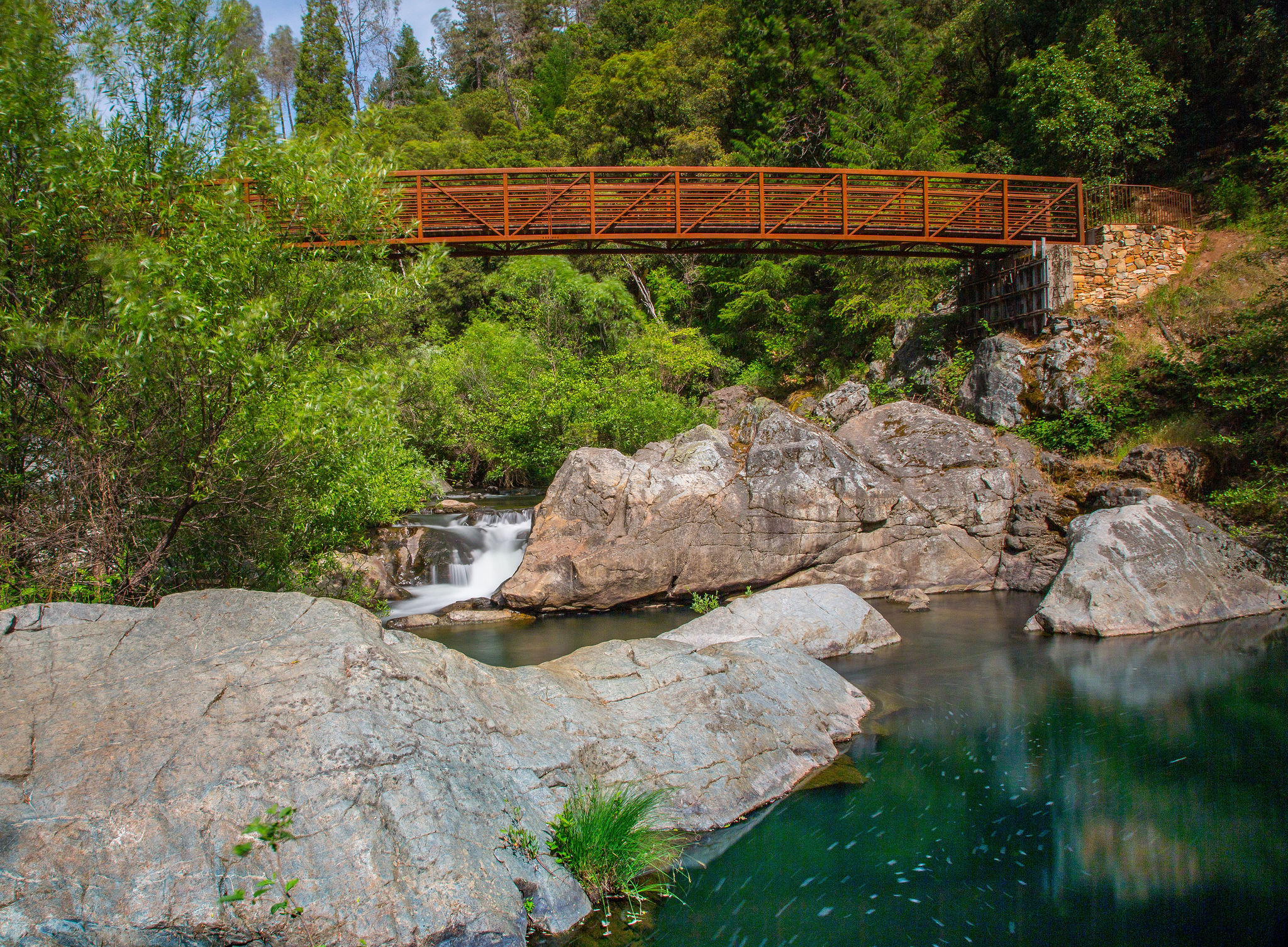
- Angkula Seo (Nisenan Tribute Bridge): A 150‑foot suspension span paying tribute to the Nisenan people—an ideal spot to pause and listen to the creek below.
- Chinese Tribute Bridge: A distinct footbridge of wood and metal that honors the Chinese miners who shaped Nevada City’s mining history.
These bridges frame a hike steeped in natural beauty and cultural resonance, complemented by interpretive signage illuminating the region’s entwined stories. Shaded benches and creekside pull-offs offer perfect places to cool off.
When to Visit#
Best in summer for shaded walks and creekside relief. Spring brings blooms, and fall lights up the forest canopy with color.
Sample the Local Flavor#
After your hike, pick up a scoop of ice cream at
Treats or enjoy a cold drink on the patio at Heartwood Eatery. For a sit-down meal, Three Forks Bakery & Brewing Co. delivers wood-fired pizza and local brews just minutes away. On many evenings, you might catch live performances by local favorites at Nevada City’s Hot Summer Nights event, adding to the charm.
2. Wolf Creek Trail – Grass Valley#
Overview#
- Length: ~1.2-mile loop (paved and natural surface)
- Elevation Gain: ~180 ft
- Difficulty: Very easy
- Time: 30–60 minutes
Where to Access#
- Park and access the trail near the North Star Mining Museum (Mill Street & Allison Ranch Road).
- Another entrance is off Freeman Lane, near River Otter Way, with clear trail signage and parking.
The Trail#
A serene shaded loop hugging Wolf Creek, featuring benches and creek access points perfect for a quick foot dip. The Daspah Seyo Trail provides a quieter, redwood-lined horseshoe loop further along the route.
When to Visit#
Ideal any time of year, but summer’s dense shade and creekside breeze make it especially restorative.
Sample the Local Flavor#
After your walk, swing by the Northstar Mining Museum to dive into the area’s rich mining history. Then grab a bite to eat Gary’s Place on Mill Street—one of Grass Valley’s longtime staples for hearty pub fare and a cozy atmosphere. While you’re there, take a stroll through the beautifully renovated Mill Street Promenade, a pedestrian-friendly stretch lined with shops and shaded seating that captures the town’s vibrant spirit.
3. Hardrock Trail – Empire Mine State Historic Park – Grass Valley#

Overview#
- Length: ~1.6-mile loop; extendable to 3+ miles via connector trails
- Elevation Gain: ~200 ft
- Difficulty: Easy
- Time: 45–90 minutes
Where to Access#
- Park on Empire Court, Grass Valley and enter through Penn Gate.
- Parking via this gate is free; please lock your vehicle and secure valuables.
The Trail#
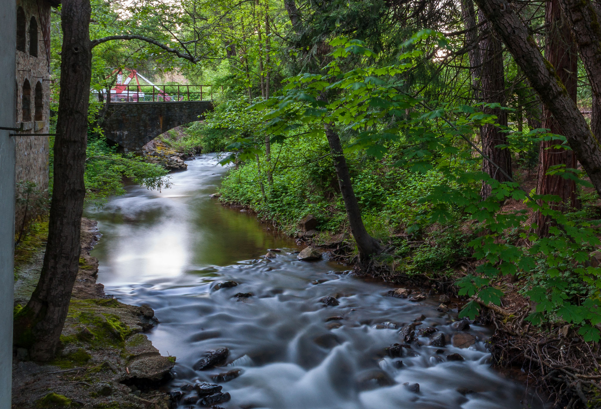
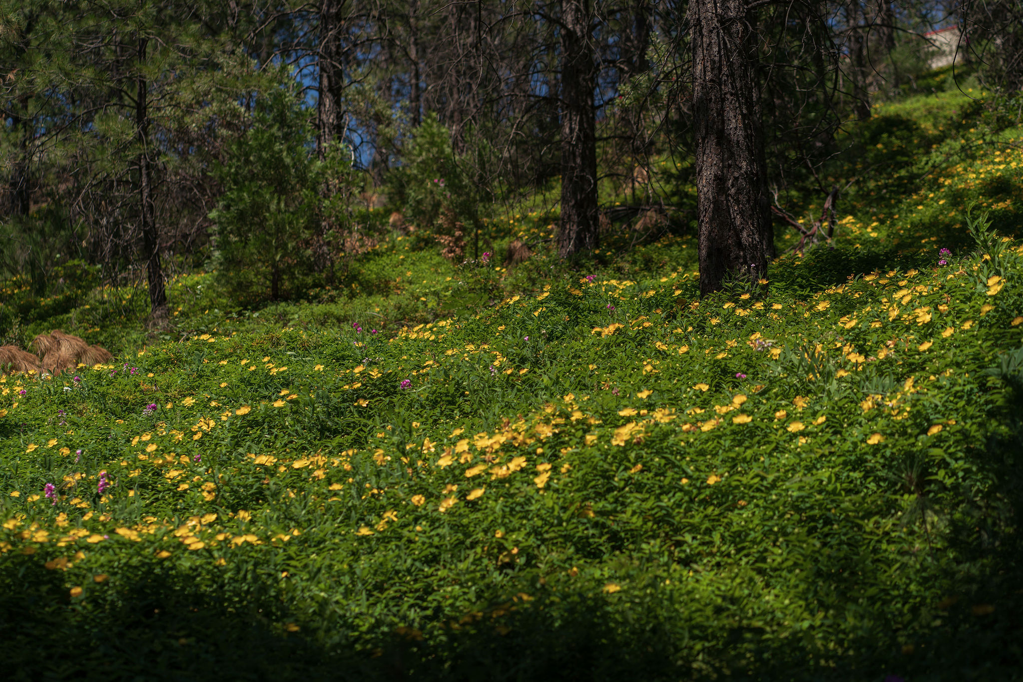
From just inside Penn Gate, the Hardrock Trail dips beneath towering pines, passes historical mining remnants, and crosses Little Wolf Creek by a wooden footbridge—creating a shaded and refreshing summer loop. The path is wide, well-kept, and accessible to hikers, mountain bikers, and equestrians.During warmer months, be alert for rattlesnakes and keep pets close—this is a common time for them to be active along trail edges.
When to Visit#
Cool, shady, and breezy in summer. Spring adds wildflowers near the creek, and fall brings a soft carpet of golden needles and delicious autumn color.
Sample the Local Flavor#
Begin your outing with a cup at Carolines Coffee Roasters. After the hike, enjoy a refreshing meal at Tofanelli’s Gold Country Bistro, complete with a shaded patio just blocks away.
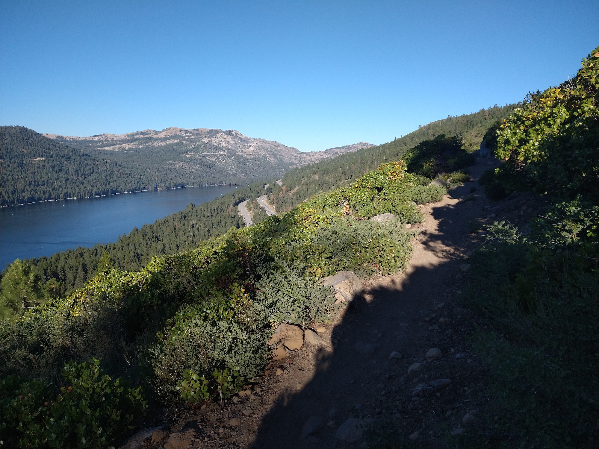
4. Donner Lake Rim Trail – Truckee#
Overview#
- Length: Up to 23 miles (multiple segments available for shorter hikes)
- Elevation Gain: 400–2,000+ ft depending on segment
- Difficulty: Moderate to challenging
- Time: 2 hours to full-day excursions
Where to Access#
- Glacier Way Trailhead (Tahoe Donner) – Great for shorter out-and-backs with sweeping views.
- Castle Valley Trailhead – Connects to rugged sections and offers longer-distance options.
- Donner Lake – West end parking provides access to lakeside connectors.
- Trail maps are available via the Truckee Donner Land Trust.
The Trail#
The Donner Lake Rim Trail winds through forested ridgelines, granite outcrops, and alpine meadows, offering sweeping views of Donner Lake, the Sierra Crest, and even Lake Tahoe on clear days. Highlights include Eagle Rock Overlook, glacial features like smooth granite slabs and erratics, and possible wildlife sightings such as mule deer, hawks, and the occasional black bear.
When to Visit#
Late spring through early fall offers optimal conditions, with wildflowers peaking in June and fall colors arriving in October. Expect snowpack to linger into early summer on higher sections.
Sample the Local Flavor#
Refuel in Truckee after your adventure. Grab a lakeside sandwich at Sticks Market or swing by Wild Cherries Coffee House for fresh smoothies and wraps. Celebrating? Enjoy a cold, refreshing pint at one of Truckee’s five local breweries. And don’t skip dessert—Little Truckee Ice Creamery serves up house-made scoops right on Donner Pass Road.
Cool Off Wrap-Up: Where Shade Meets Water in Nevada County#
When the days grow hot, a simple walk among trees or beside quiet water can offer deep relief. From the shaded bridges of Deer Creek, to the tranquil paths of Wolf Creek, to the forested serenity of Empire Mine, these trails let you reconnect, cool off, and embrace what summer in Nevada County has to offer.Grab your water bottle and towel—these trails are calling.