
Scenic vistas, quiet river corridors, snow-capped peaks, California history, prime wildlife viewing, uncrowded trails and solitude in nature await those who venture out for some winter hikes in Nevada County. Remember to check the weather report, dress in layers, bring plenty of water and snacks, download your GPS maps, grab a hiking buddy and get ready for adventure.
Best Of Both Worlds
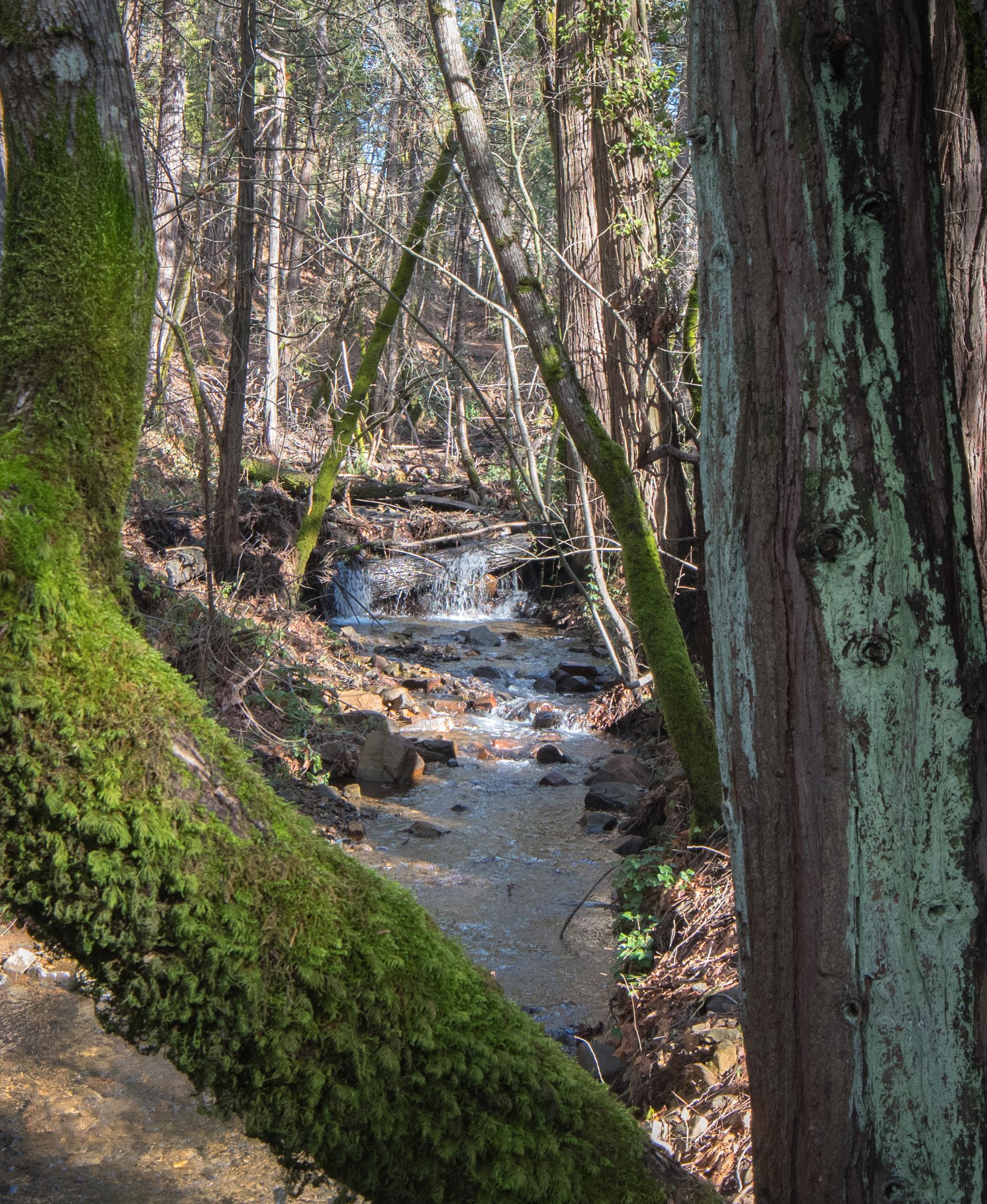
Nevada County offers the best of both worlds when it comes to outdoor playgrounds in winter. You’ll find exploring lower-elevation trails in the Yuba River watershed magical in the off-season. Trails are less populated, creeks and rivers are rushing with impressive storm runoff and you’ll find a stillness in the forest, a green lush wonderland bathed in soft light. Did we mention that birdwatching is prime? We recommend bringing a camera and binoculars and going quietly into the woods for the best wildlife viewing. Looking for a guided outing? Check out Inn Town Campground’s event calendar for upcoming guided hikes.
Where To Go Hiking
In the high country, when snow blankets the Sierra Nevada range, hikers can strap on a pair of snowshoes to enjoy alpine trails. Have you ever snowshoed by moonlight? Here are a handful of our favorite winter hikes in Nevada County to get you started. Please help us keep our trails beautiful by remembering to always pack out what you pack in!
Hirschman’s Trail & Pond
Nevada City
Difficulty: Easy Length – 4.8 miles
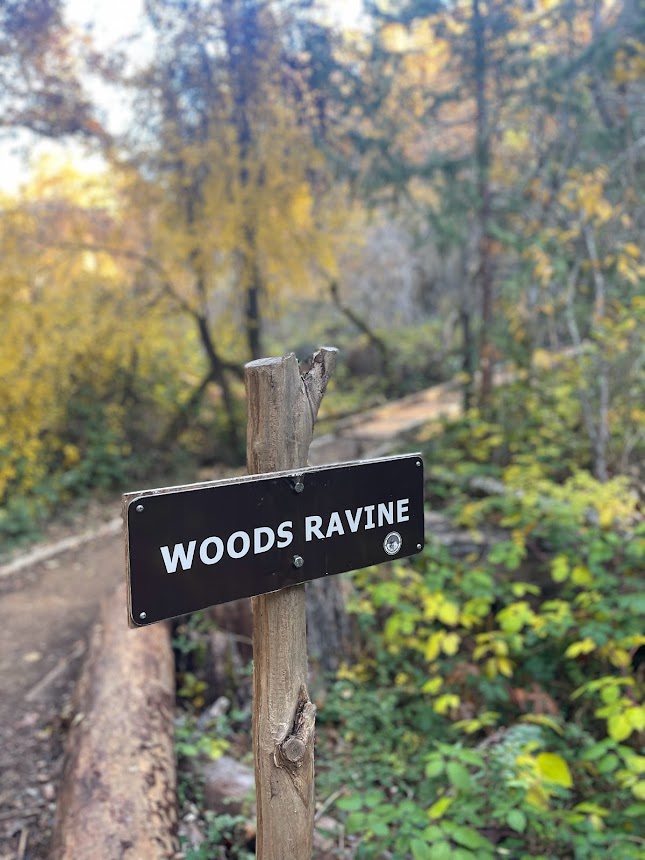
Located a short mile from the heart of historic downtown Nevada City, this accessible urban trail gets you quickly into a mixed conifer forest and the first .4 mile is wheelchair accessible. This one is great for families with young kiddos. Hirschman Pond is a bird-lovers paradise and if you’re lucky you might see a family of otters! Interpretive signs tell the story of this place named after pioneer miner Leb Hirschman and the environmental upheaval created by hydraulic mining more than a century ago. Visible are the giant boulders, exposed cliffs and a hummocky landscape shaped by giant water canons in the search for gold. For those who want a solid walk, keep following the trail past the pond to Woods Ravine and beyond. Check out Bear Yuba Land Trust, for a map and full trail description.
Deer Creek Tribute Trail to Angkula Seo Bridge
Nevada City
Difficulty: Easy – Moderate Length – 1.5 – 3 miles
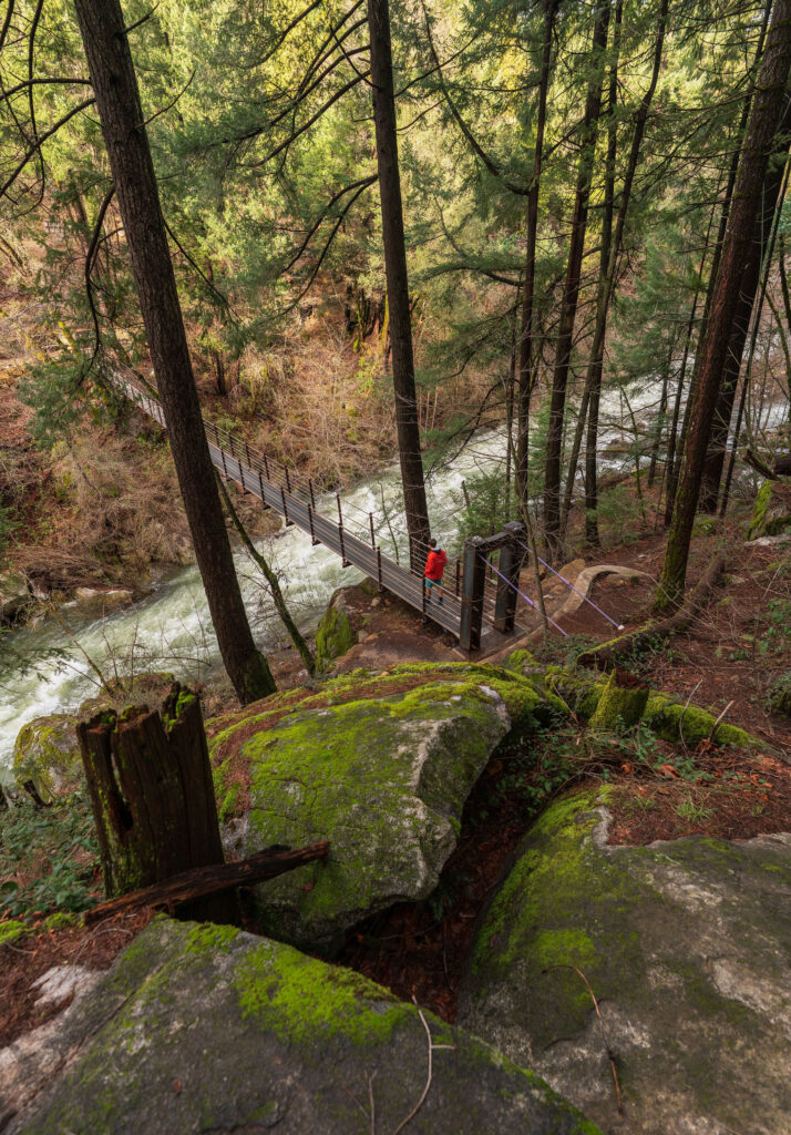
This popular trail is close to downtown Nevada City and is a perfect excursion after grabbing a quick coffee and scone. The popular swinging suspension bridge makes an ideal photo opportunity and the many interpretive signs along the way tell the story of the local Nisenan. Lots of interesting California native plants to identify. We recommend grabbing a plant identification or Nevada City history book at a local bookstore before heading out! Deer Creek Tribute Trail is part of a large network of trails and commemorates the Nisenan and the Chinese miners who worked the mines along Deer Creek during the gold rush. Find a map at Bear Yuba Land Trust.
Wolf Creek Trail
Grass Valley
Difficulty: Easy Length – 1.2 miles
This new out & back trail opened in 2018 and passes the Northstar Mining Museum and Glenn Jones Park. The trail runs parallel to Wolf Creek and crosses Little Wolf Creek. Also known as Daspah Seyo Trail in recognition of the Nisenan who historically made this waterway their home. Learn more at BYLT and check out the good work of Wolf Creek Community Alliance.
Hardrock Trail Loop
Grass Valley
Empire Mine State Historic Park
Difficulty: Easy – Moderate Length – 2.4 miles
This popular trail for hikers, mountain bicyclists and equestrians weaves through Empire Mine State Historic Park, the site of one of the oldest, deepest, and richest gold mines in California. Conveniently located in Grass Valley, the park is a backcountry dream with 856 forested acres and 14 miles of trail. If you can, make time to explore the view at the top of Osborne Hill, the visitor center and beautiful Victorian-era grounds with an heirloom rose garden and the Bourne Mansion! Dogs are welcome on the trails but must be on a leash. Learn more about the park here.
Buttermilk Bend Trail
Penn Valley
South Yuba River State Park, Bridgeport
Difficulty: Easy Length – 1.2 miles
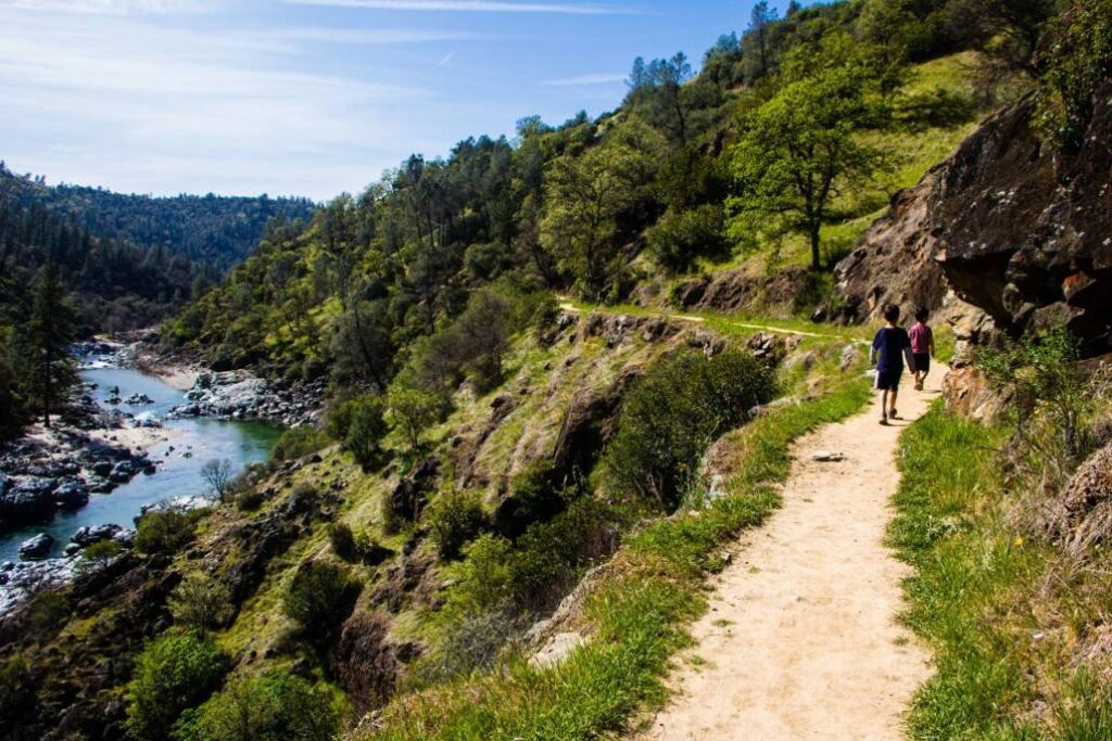
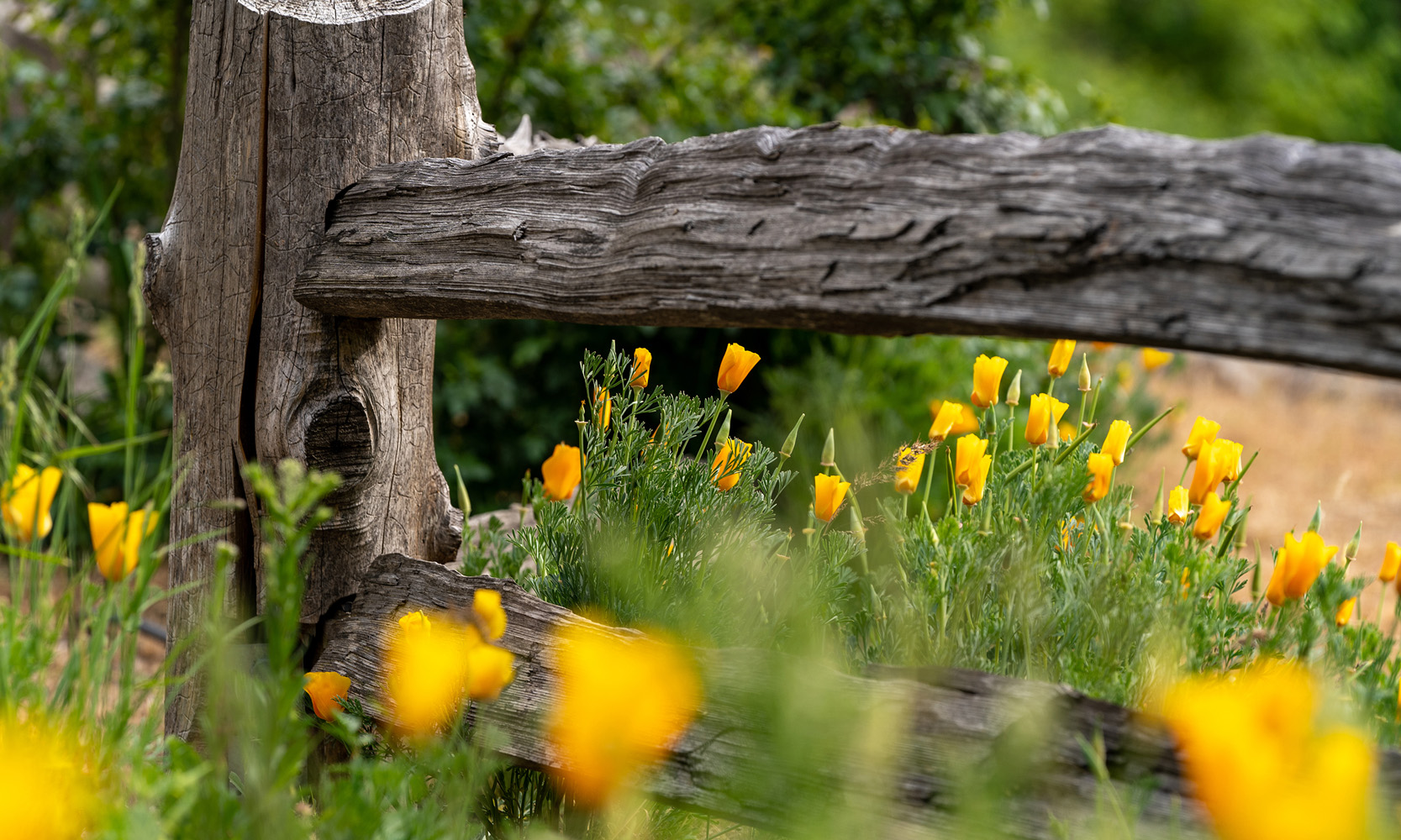
A favorite in spring for the show-stopping wildflower display, this trail has a quieter, raw beauty in winter when the South Yuba River is rushing. Lots of California native plants if botany is your thing. Be sure to stop by the park’s visitor center for maps and plant identification guides. Keep an eye out for newts in the creeks. If you want a more strenuous workout, hop onto the Defiance Loop Trail. Don’t forget to check out the newly restored wooden covered bridge! Guided docent hikes are available Mid-March to Mid-May. Learn more about the South Yuba River State Park here.
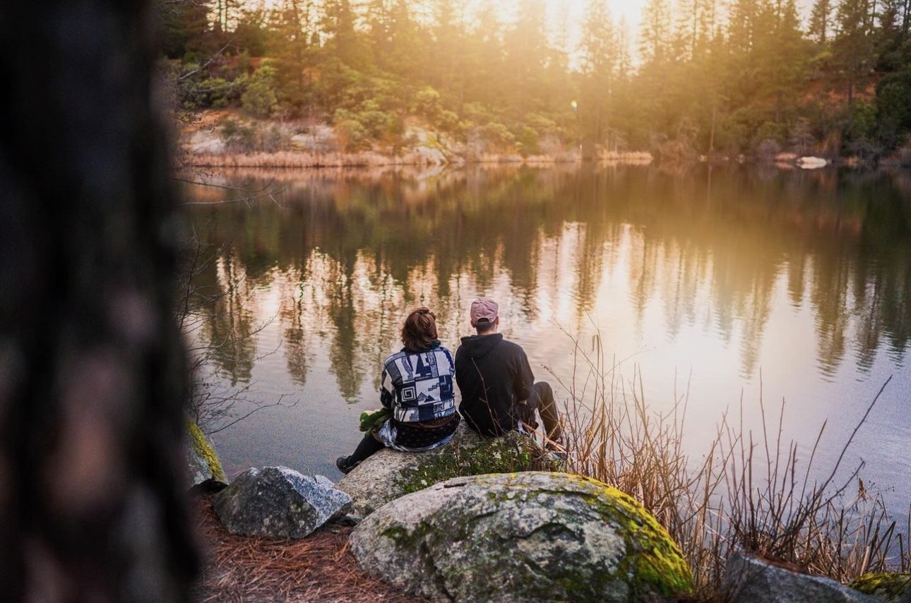
Lake Loop Trail
Truckee
Donner Memorial State Park
Difficulty: Easy Length – 2.5 miles
Who says you can’t go hiking in the snow? Stop by one of Nevada County’s local mountaineering stores to rent or buy your own gear before heading out to the trail. Donner Memorial State Park is a great place to start, and easy enough to bring the whole family. The Lake Loop Trail follows the shoreline of Donner Lake, the “Gem of the Sierra” and provides jaw-dropping views of historic Donner Pass, Schallenberger Peak and Donner Peak. Look for eagles fishing in the lake and wildlife tracks from snowshoe hares, raccoons and foxes in the snow. For more experienced adventurers who want a longer hike, venture out along the Coldstream Trail in Coldstream Canyon, following the route of early pioneers on the California Trail! Find a map here.